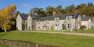


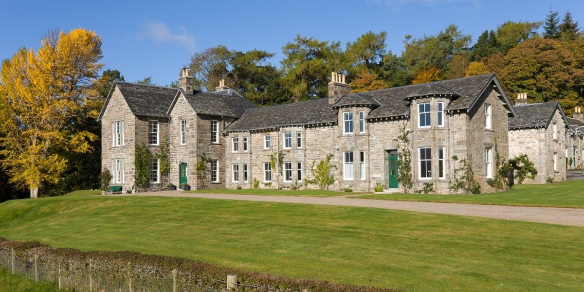
The Lodge
Set in a 3 acre garden with panoramic views over Loch Rannoch, Craiganour Lodge has 9 double bedrooms, all ensuite, including a large accessible bedroom on the ground floor. The fully equipped semi professional kitchen is suitable for use by both chefs and guests. Craiganour Lodge has been in the same family for four generations, and as such has a rich history of welcoming guests from all around the world. The interior aesthetic reflects this history, while maintaining a contemporary feel and boasting spectacular views from every room.

Skyspace
Created by renowned artist James Turrell at the dawn of the 21st. century, the Craiganour Skyspace invites an embodied transformative experience. Set within the Highland landscape, it opens an aperture to the heavens, transforming the colour of the sky and asking us questions such as how much of what we perceive is ‘out there’, and how much do we influence what we perceive of the world from within.

© Richard Webb, license: CC BY-SA 2.0
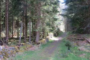
Rannoch Forest Trail
A network of waymarked walking routes through the ancient pinewoods on the southern shore of Loch Rannoch, part of the historic Black Wood. A surviving fragment of the Caledonian forest, home to native Scots pine, juniper and abundant wildlife.
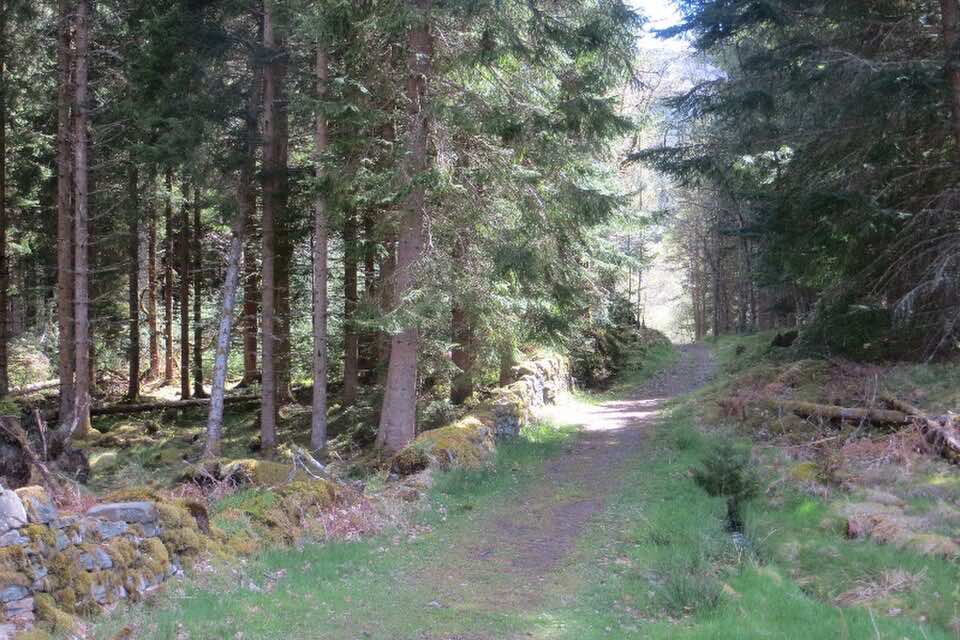
© Andrew2606 at English Wikipedia, license: CC BY 3.0
Schiehallion
A distinctive cone-shaped Munro rising to 1,083 metres on the south side of Loch Rannoch. Famous for the 18th-century experiments by Nevil Maskelyne to estimate the mass of the Earth, its near-symmetrical form makes it one of Scotland\'s most recognisable peaks.
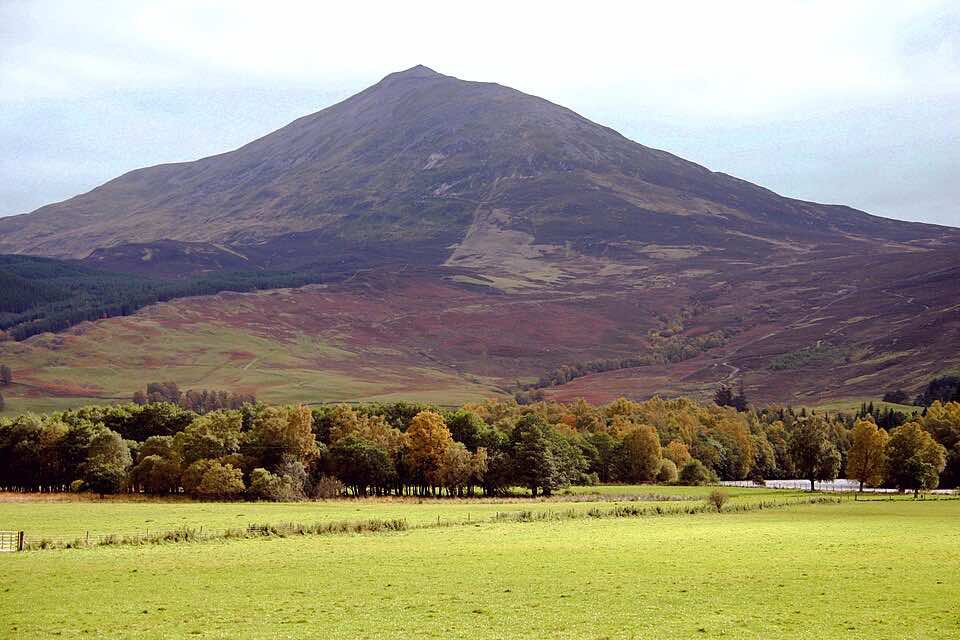
© Mick Garratt, license: CC BY-SA 2.0
Eilean Nam Faoileag (The Island of Gulls)
A folly was constructed on the island in the nineteenth century, reputedly by a Baron Granbley. The folly, which is still standing, takes the form of a tower, and may be based on the design of a small island prison. There may also be crannog at Eilean Beal na Gaoire at the very western end of the loch, however the level of the loch has been raised causing the island to become submerged, and so its status as a crannog was regarded as uncertain when surveyed in 1969.
© Ronnie Leask, license: CC BY-SA 2.0
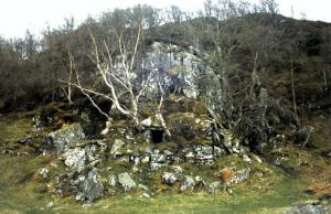
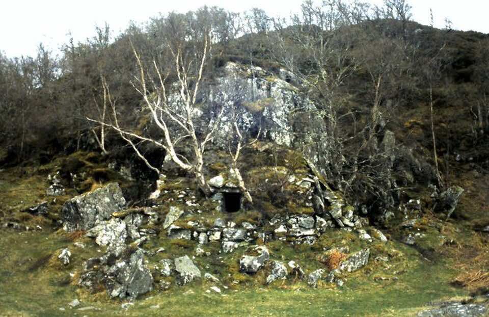
MacGregor's Cave
A hillside cave reputed to have sheltered Clan Gregor outlaws during the proscription of their name in the 17th century. Concealed among rocks above Loch Rannoch\'s north shore, it remains a popular spot for hill walkers seeking a slice of Highland history.
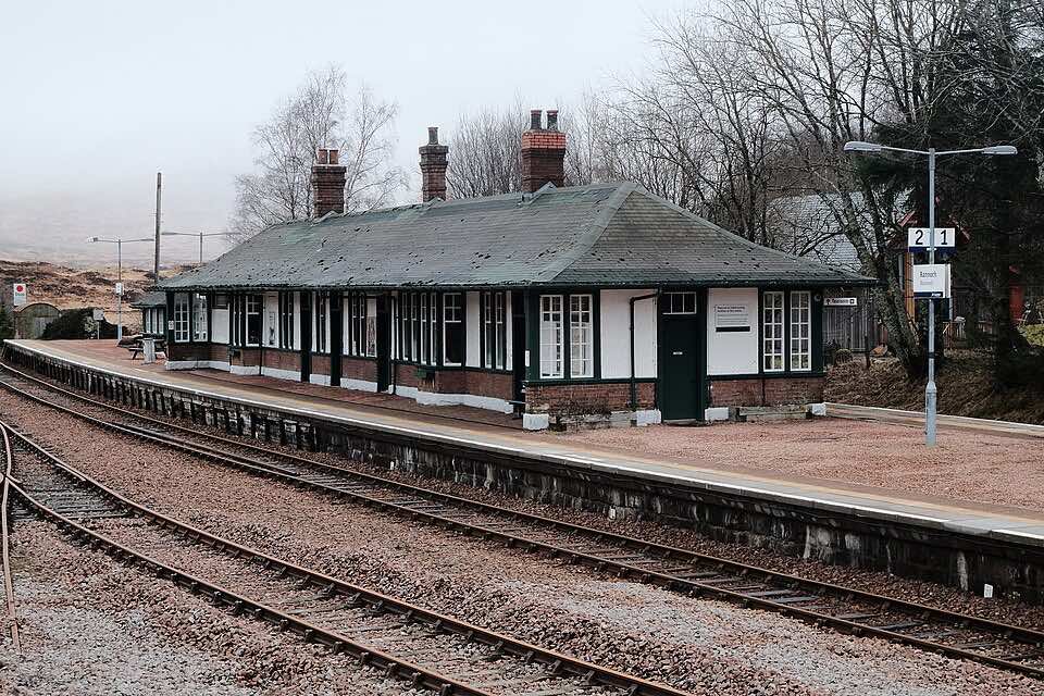
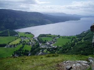
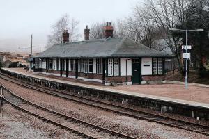
Rannoch Station
An isolated railway station on the West Highland Line, surrounded by the vast expanse of Rannoch Moor. One of the most remote stations on the British rail network and a popular launch point for moorland walks.

© Dave Taylor / Kinloch Rannoch and Loch Rannoch from Craig Varr / CC BY-SA 2.0
Craig Varr
The crags of Craig Varr are a popular venue for rock climbers being close to the road and parking spots. The 100-metre-high (330 ft) schist crags contain around 30 routes from 30 to 50 metres in length, varying in grade from Very Difficult to Very Severe. The crags are south facing, a fact which adds to their popularity, being quick drying and catching plenty of sunshine. Craig Varr is usually ascended from the south or the east. From the south there are routes from Kinloch Rannoch and Drumglas. From Kinloch Rannoch the route goes up the Allt Mòr, passing a fine waterfall before going steep up to the summit ridge.
Locations
Craiganour
Immerse yourself in the peaceful and transformative nature of this place while creating your own experience.
- The Lodge
- Skyspace
Rannoch
Rannoch is a stunning, remote region of the Scottish Highlands, renowned for its dramatic landscapes, ancient Caledonian pine woods, and the vast, heather-clad wilderness of Rannoch Moor.
- Rannoch Forest Trail
- Schiehallion
- Eilean Nam Faoileag (The Island of Gulls)
- MacGregor's Cave
- Rannoch Station
- Craig Varr
About this app
Visit the tourbod website for more information.
Welcome
Tourbod is a wayfinding compass for the places around you. It points to local landmarks and tells you how far away they are — not turn-by-turn directions, more like a quiet companion for getting your bearings.
The compass
The dial in the centre shows the locations nearest you. The closer a location, the closer its label sits to the dial. As you turn, the compass turns with you — north stays north, and the labels rotate to keep their bearings. As you move, the rings re-order themselves so the nearest location is always on the innermost ring.
Headings and distances update in real time. No need to refresh, no taps required — just hold the phone roughly level and let it read your direction and position.
The horizon strip
Above the compass, the horizon strip shows what's currently in front of you. Locations slide along it as you turn: a location dead ahead sits in the middle, while one off to your side drifts toward the edges and disappears once it's behind you.
List view
Tap the list icon in the toolbar to swap the compass for a vertical list of the same locations, sorted by distance. Tap the compass icon to swap back. The list updates live too — bearings rotate, distances tick, rows re-order as you move.
Categories
Tap the categories icon in the toolbar to choose which locations are shown. Locations are grouped into categories — landmarks, walks, viewpoints — and you can toggle a whole category on or off, or control individual locations within one.
Location details
Tap any label on the compass, or any row in the list, to open a panel with a photograph, description, and exact bearing and distance. Swipe left or right inside the panel to move between locations, or pull down to dismiss.
Tips
- Hold the phone roughly level, screen up. The compass works best when the device isn't tilted heavily.
- Allow location access. Without it, the compass can't tell you where locations are relative to you.
- Step outside if bearings feel unstable. Buildings and large metal objects can confuse the magnetometer.
- If headings drift, tracing a figure-of-eight in the air with the phone often re-calibrates the sensor.
Version: 20260609.230932